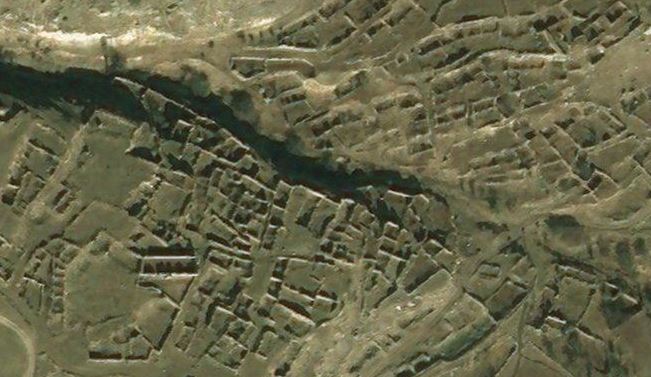
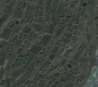
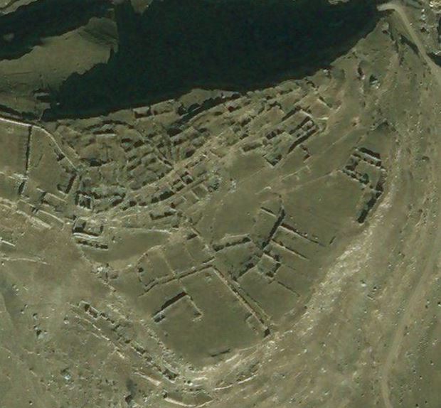
If you zoom in to Verkhnyaya Balkariya using satellite imagery on Google Maps or Bing, you notice, like a palimpsest, the history of past settlement around the modern planned town with its regular and rectilinear grid-like layout. As at the time of writing (January 2018), the Microsoft satellite imagery used by Bing is clearer than Google’s as it was taken in good light. Below are screenshots showing five of the vanished villages and hamlets of Upper Balkaria.
Glashevo:

Kospart:
Kyunlyum:
Mukush:
Sauty:

The accompanying Google Map shows the main villages (blue pins) and various hamlets and neighbourhoods (grey pins) of this part of the Cherek river valley in Upper Balkaria. Until Nov-Dec 1942, these were entirely populated by Balkars, a Turkic and Muslim people of the north Caucasus. At that date, these Balkar villages were razed and the population decimated – men, women and children were brutally killed by the Red Army on the orders of the NKVD. As you can see from the images above, the villages were completely destroyed and only a ruined archaeology remains.
In March 1944 the balance of the inhabitants of Upper Balkaria, together with all other Balkarians (37,103 in total, according to NKVD head Lavrentiy Pavlovich Beria’s official report), was deported en masse to Central Asia (mostly the Kazakh and Kyrghyz Soviet Socialist Republics). There they remained in exile until a decree of March 1957 permitted the survivors to return to their homeland.
According to the 2010 census, Balkars make up 12.7% of the population of the Russian Republic of Kabardino-Balkaria (being outnumbered by the indigenous Kabarday, who comprise 57%, but also by ethnic Russians, who make up 22%).

You must be logged in to post a comment.