Armenian Kayseri, 1872

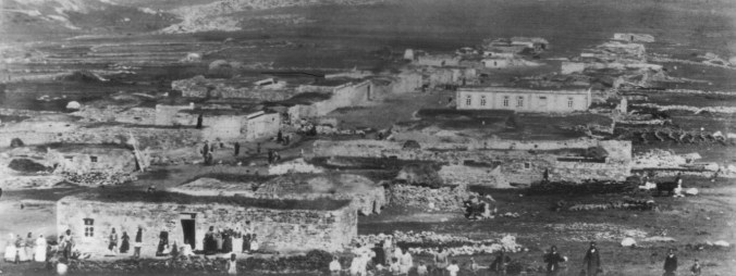
The 1872 defter, or taxation schedule, from Kayseri in Turkey (Gesaria or Kesaria in Armenian) is arranged by mahalle and, within that, by street. The taxpaying householders in each street are then listed. There were 8,119 taxpaying households in total in Kayseri in 1872.

At that date, Kayseri had a total of 108 recognised mahalleler or neighbourhoods, comprising between 16 and 352 households each, with the mean being 75 homes. 67 neighbourhoods were exclusively Turkish, 25 were Armenian, two were Kurdish and one was Greek. However, Greeks and Armenians lived together in some Christian quarters and there were seven neighbourhoods with a mixed Armenian/Turkish population.

The original archival material is in Osmanlı Turkish, written using a modified Arabic alphabet, and has been transliterated and transcribed into modern Turkish, which of course uses the Latin alphabet. One needs to understand the pronunciation of certain Turkish letters to be able to match them with the approximately corresponding letters used in English to spell Armenian names in transliteration. For example, the Turkish letter c may be the equivalent of j or dj, and ç and ş represent the sounds ch (or tch) and sh respectively.

Armenian and Greek personal names are rendered in Turkish style, using the suffix -oğlu to indicate “son of”, rather than an Armenian or Greek surname ending. The entries are terse and it is not always clear whether a surname has already been assumed by a family or, contrarily, a simple system of patronymics is still in use – for example, in the case of entries in the format “Manük oğlu Serkis”, it is not certain whether the individual in question is Sarkis Manoukian, or simply a Sarkis son of Manouk with no settled surname (or with a surname not recorded). Contrarily, when the entry is in the format “Demiroğlu Karabet”, it seems clear that the man’s name is Karabet (or Garabed) Demirian.

It is worth noting that the Armenians of Kayseri were native Turkish speakers.

I began by looking for surnames I knew from previous research to be associated with the town and/or sanjak of Kayseri. I was able to find only about one quarter of these. Either the other names were not from Kayseri itself but an outlying town or village, or they had not been taken by 1872 (which seems less likely).

Some of the names in the defter are simple to match to modern Armenian names, for example:

  • Arzuman oğlu Parsıh = Parsegh Arzumanian or Arzoumanian
  • Beyleroğlu Mardiros = Mardiros Beylerian
  • Erkiletlioğlu Karabet = Karabet Erkiletlian
  • Gürünlüoğlu Kesbar ve Avidis = (brothers) Kasbar and Avedis Gurunlian (or Gourounlian)
  • Kalaycıoğlu Mardiros = Mardiros Kalaydjian
  • Keşişoğlu Kalus = Kaloust Keshishian
  • Minasoğlu Hacı Agop = Agop Minasian
  • Odabaşıoğlu Agop = Agop Odabashian
  • Şahinoğlu Karabet = Karabet Shahinian
  • Seferoğlu Parsıh ve Artin = (brothers) Parsegh and Artin Seferian
  • Taşçıoğlu Ohanes = Ohanes Tashjian

Other names are less confident matches:

  • Acemoğlu Karabet = Karabet Ajemian
  • Dökmecioğlu Agop = Agop Deukmejian

The records mainly involve heads of household, as the taxpayers, and these are usually men – however, there are some women, perhaps mostly widows or women who had inherited property or had established a charitable trust (vakif).

Below are details of the Fırıncı mahallesi. Its name means simply “bakers’ neighbourhood” and it was a small, entirely Armenian quarter of the town, comprising just five streets with 23 taxpaying households, of which 21 are named in the defter. These households are shown in the table below.

street householder interpretation
Hamame Sokağı Kırnıkoğlu Hacı Karabet Karabet Kirnikian
Hamame Sokağı Mardinoğlu Karabet Karabet Mardinian
Hamame Sokağı Kazancıoğlu Hacı Agop Agop Kazandjian
Hamame Sokağı Acıroğlu Artın Artin Adjirian
Kazancı Sokağı Kazancıoğlu Murat Murat Kazandjian
Muytab Sokağı Ağlağanoğlu Hacı Agop Agop Aghlaghanian
Muytab Sokağı Keşişin oğlu kızı Meryem Miss Mariam Keshishian
Muytab Sokağı Köseoğlu kuyumcu Hacı Parsıh goldsmith Parsegh Keseian
Muytab Sokağı Külhancıoğlu Bedirus Bedros Kulhandjian
Muytab Sokağı Acıroğlu Keyfuruk Kevork Adjirian
Muytab Sokağı Çoduloğlu Agop Agop Tchodulian
Muytab Sokağı Ohanes oğlu Parsıh Parsegh Ohanesian, or Parsegh son of Ohanes
Muytab Sokağı Sade Agop oğlu Artin simple Artin Agopian, or Artin son of Agop
Gümüşoğlu Sokağı Berber Ohanes Ohanes Berber, or Ohanes the barber
Güllük Sokağı Abacıoğlu zevcesi Ehsabet Mrs Yeghsabet Abadjian
Güllük Sokağı Güllükoğlu Bedirus Bedros Kullukian or Koulloukian
Güllük Sokağı Üskü oğlu Karabet Karabet Ouskouian
Güllük Sokağı Güllükoğlu kızı Meryem Miss Maryam Kullukian or Koulloukian
Güllük Sokağı Çulha Muratoğlu Mığırdıç weaver Mgrdich Muratian
Güllük Sokağı Ağacanoğlu şekerci Artin confectioner Artin Aghadjanian
Güllük Sokağı Hızarcı Manikoğlu Karabet sawyer Karabet Manikian


Some thoughts on these householders:

  • Two of the streets appear to be named after the principal family in residence – the Kazandjian household in Kazancı Sokağı and the Kullukian or Koulloukian household in Güllük Sokağı (“roses street”).
  • The occupations of four of the householders are given – goldsmith, weaver, confectioner, sawyer. A fifth man – Ohanes, the sole taxpaying resident in Gümüşoğlu Sokağı – is either a barber or bears the surname Berber or Berberian – the original record does not make it clear. Given the name of this mahalle, one would assume that at least one of the men without a given occupation was a baker.
  • Three out of the 21 are women – two described as daughters (kızı in Turkish) and one as a wife (zevcesi), and presumably are respectively spinsters and a widow.
  • Four of the male householders have their forename prefixed with Hacı (Hadji), which would normally indicate that they had performed the pilgrimage to the Holy Land.


The Google Map shows the Armenian settlements in the Kayseri province of the Ottoman Empire before the 1915 Genocide.


This article and map are versions of originals which were published by bluebirdresearch.com in 2013/2014.

Turkish names of Armenian villages in Kars province

The place name concordance below shows the Armenian settlements of Kars oblast (province) of the period 1900s/1910s, taken from late Imperial Russian gazetteers. It is designed to help Armenian family historians to locate their ancestral villages, and should be read in conjunction with the Google Map showing the same Armenian settlements under their current Turkish names.

The table gives a) the names as transliterated from the Russian Cyrillic in Imperial Russian official publications, b) their Armenian names in standard transliteration and c) their modern Turkish names.

All errors are the blogger’s own. Additions and corrections are welcomed.


Russian name Armenian name Modern Turkish name
Kars Kars Kars
Zaim Zayim Harmanlı
Matsra Mazra Mezra
Dahskovo Dashkov Yalinkaya
Norashen    
Bulanikh Bulangh Bulanık
Kani-Key Ghani Gelirli
Karakala Karakala Merkezkarakale (Karakale)
Chermali Chermali Çerme
Berna Berna Koyunyurdu
Khas-Chiftlik Khas-Chiftlik Hasçiftlik
Gyarmali Gyarmali Kaynarlı
Giudali Gyodali Güdeli
Karakhach Garaghach Başkaya
Sogiutli-Abad Abat-Sogyutli Atayurdu
Chigirgyan Chghrdan Çığırgan
Khapanli Ghapanli Hapanlı
Bozgala Bozgala Bozkale
Begli-Akhmed Beghli-Ahmed Benliahmet
Orta-Kilisa Ortakilisa Ortalar
Kizil-Chakhchakh Kzil-Chaghchagh Akyaka (Garmirçağatsk)
Uzunkilisa Uzunkilisa Esenyayla
Aguzum Aghuzum Küçükaküzüm
Pirvali Pirvali Büyükpirveli (Eski Pirveli)
Odzhakh-Kuli Ojakh-Ghuli n/a (in Armenia)
Kiuruk-Dara Ghyurakdara, Gyurakdara Kürekdere
Paldirvan Paldrvan Duraklı
Parget (Bolshoy) Metz Parkit Büyükçatma
Bash-Shuragel Bash-Shoragyal Şetindurak
Tikhnis-Stariy Hin Tegniz Kalkankale
Tikhnis-Noviy Nor Tegniz Kalkankale
Ashaga-Kadiklyar Nerkin Gyadiklar Ayakgedikler
Bayrakhtar Bayraktar Bayraktar
Gamzakyarak Ghamzakyarak Hamzagerek
Gerkhana Gorghana Eşmeyazı
Araz-Ogli Arazi Arazoğlu
Dzhala Jala Esenkent
Adzham-Mavrak Acham Mavrak, Ajam-Mavrag Bekler
Karmirk-Vank Karmir Vank Yağıkesen
Koshevank Khoshavank n/a (in Armenia)
Kuyudzhuk Ghuyujugh Kuyucuk
Tazakent Tazakend Tazekent
Bash-Kadiklyar Bash Gyadiklar Başgedikler
Oguzli   Oğuzlu
Orta-Kadiklyar Orta Gyadiklar Ortagedikler
Agdzhakala Aghjaghala Akçakale
Kyadik-Satilmish Gyadik-Satlmish Gediksatilmiş
Parget (Maliy) Pokr Parkit Küçükçatma
Dolbant Dolbandlu Dölbentli
Baykara Bayghara Baykara
Bayburt Bayburt, Paypert Bayburt
Ortakala Ortaghala Ortakale
Sogiutli-Prut Brut-Sogyutlu Söğötlü
Yeski-Kazi, Eski-Kazi Aksi-Ghazi Eskigazi
Karamamed Gharamahmed n/a (in Armenia)
Bezirgyan Beyirgan Eskigeçit
Ardagan Ardahan Ardahan
Okam   Çayirbaşi
Urut Urut Bellitepe
Kagizman Kaghzvan Kağızman
Karabakh Gharabagh Karabağ
Kers Gers Günindi
Khar Khar Çallı
Yenidzha, Enidzha   Yenice
Karavank Gharavank Taşburun
Changli Chankli Çengilli
poselok Todan   Esenkır
Zirchi Zrchi Yağlıca
Pivik-Armyanskiy Bvik Karaboncuk
Laloy-Mavrak Laloy-Mavra Dolaylı
Pakran Bagaran Kilittaşi
Akryak Agarak Derinöz
Dzhalal Jalal Celal (Celalköy)
Zibni Tzpni Varlı
Digor Tikor Digor
Yelisavetinskoe,

Elisavetinskoe

Elisaveta  
Nakhichevan Nakhichevan Kocaköy
Kosha-Kilisa Ghoshakilisa Şehithalit
Khoperan Goberan Gecikmez
Shadevan Shatevan Belencik
Bashkey with poselok

Cholakhli and Kara-Pungar

Cholaghli and

Gharapunghar

Başköy, Çolaklı, Karapınar
Giulyantapa Gyulantara Beşyol
Sitagan Stahan Eşmeçayır
Akh-Kilisa Aghkilisa  
Armutli Armutlu Armutlu
Churuk Churuk Çardakçatı
Olti Olti Oltu
Dzhudzhurus Jurjuris Subatuk
Zardanes Zardanes Sarisaz
Tamrut Temrut Şendurak
Kubad-Yeriuk Yoruk Derebaşi
Akryak Agarak Sindiran
Pertus Bardus Zömrüt
Olor   Olur


This blog, concordance and map were first published on the bluebirdresearch website in 2011/12.


Syriac settlements in Tur Abdin, Turkey

The Google Map shows some of the Syriac (Suroye or Assyrian) communities in the Tur Abdin region of Kurdistan in SE Turkey, together with a few of their surviving Syrian Orthodox monasteries. In addition, some settlements slightly further afield are also shown, north towards Batman and east towards Cizre.

The map uses the Syriac (rather than modern Turkish) place names. The Turkish toponym can be seen by zooming in on the map. As part of an aggressive Turkification programme, from the 1920s nearly all non-Turkic place names in Turkey were eradicated; this was systemised and codified in article 1 of the 1936 Law for Provincial Rule (Türkiye Büyük Millet Meclisi Zabıt Ceridesi, v12, pV,  s1). 91% of place names in Mardin province, which covers Tur Abdin, have been Turkified.

Place names on the map are given in simplified transliteration from the Turoyo (modern Aramaic) used by the Syriacs, without the use of diacritics. As a place name can be transliterated in different ways, some variants are also shown (click on a pin to see). Places are ordered using the Latin alphabet.

Included are some places of historic occupation with no extant Syriac population (due to genocide, persecution and emigration).

It is estimated that there were 200,000 Syriacs in this region prior to the 1915 massacre and deportation of Christians in Anatolia. The Syriac population of Tur Abdin is now as little as 1,765 (2015 figure; according to a register of the community kept by the Mor Hobil & Mor Abrohom monastery).

Armenian Karakala, Kars

Among the Californian Armenian community is a disproportionate number of descendants of immigrants from the small village of Karakala, or Kara-Kala, near Kars. On incoming American passenger lists and in naturalisation records, the place of origin of these immigrants will usually be shown as Russian Armenia, because the region around the city of Kars became the Russian Karsskaya oblast from 1878 to 1917. Before that period, the region was part of the Ottoman Empire and therefore a minority of US immigration records, especially for those Armenians born in Karakala before 1878, may state Turkey or Ottoman Empire, rather than Russia, as place of birth.

There is little to be found on the internet – at least, in the English language and of value to genealogists – about Karakala. There is confusion as to its exact whereabouts. The primary reason for this confusion is that the place name is not unique: there are multiple candidates. Furthermore, place names changed under modern Turkey and some Armenian villages were completely razed and have disappeared from the map. However, the true location of Armenian Karakala can be determined with confidence.

Imperial Russia, like other late 19th century empires, took a lively interest in demographics and ethnography (not least because nationalism needed to be monitored as the single biggest challenge to empire). Russian gazetteers of the period show the administrative geography (the hierarchy of local government from regional capital down to village), the population breakdown and usually something of the ethnicity (natsionalnost or nationality in Russian) of the inhabitants. The colossal 1897 Russian Census was a monument to just such a preoccupation with the population of empire.

Gazetteers for Kars oblast record the entire population down to the smallest villages of no more than 50 inhabitants. The Russian gazetteers for the 1900s and 1910s show consistently that there were nine places called Karakala in Kars oblast. However, Armenian Karakala – the source of the Californian immigrant population – is readily identified. Each of the various entries for the settlements named Karakala gives the nationality of its population. In this respect, while cities and towns in eastern Anatolia were usually of mixed population, the villages in the hinterland tended to be occupied by a single people. Only one of the nine places named Karakala had an Armenian population: of the remaining eight, seven were Muslim villages, identified carefully as Kurdish, Turcoman/Turkish and even Karapapak, and one a Yezidi village.

Under Russian rule, Armenian Karakala seems originally to have been classed as an obshestvo (community) in its own right, with the nearby Turkmen selo or village of Hadzhi-Halil subordinate to it, within the okrug (or district) of Magaradzhik (a Greek Orthodox village). However, later Karakala lost its obshestvo status and became simply a selo like Hadzhi-Halil in Magaradzhik obshestvo inMagaradzhik okrug. The other two villages in the immediate grouping were Azat (which was Greek Orthodox) and Kany-Kei (another Armenian settlement).

Across Kars oblast, the majority of Armenian settlements were growing rapidly during the years leading up to WW1, due to natural growth (families were large) and in-migration. Karakala was an exception to this trend. In 1902, the village comprised 464 souls (as they are described in the gazetteers) residing in 43 households; in 1908, 400 and in 1910 408; by 1914, it had 489 souls living in 79 homes. All were Armenian. The explanation for the mid-1900s dip and the otherwise relatively slow growth in population size and reduction in household size in Karakala is the significant emigration from the village to North America.

So where is Karakala? It is situated 17.5km SSE of Kars and is today called Merkezkarakale. The prefix Merkez (“central”) simply signifies its location in Kars Merkezi, or the central district of the Kars province of modern Turkey; this name was not used during either the Ottoman or Imperial Russian eras. 8km to the NNW is Azat; about 5km to the N is Magaradzhik, now called either Mağaracık  or Ataköy in Turkish; 5km to the NW is Kany-Kei, now known as Gelirli; and 2km to the S is Hadzhi-Halil, now spelt Hacıhalil in modern Turkish.

The first Google Map shows Armenian Karakala, marked with a yellow pin, in the context of the other Armenian settlements in Kars.


The second Google Map shows Armenian Karakala, marked with a yellow star instead of a pin, along with the non-Armenian villages named Karakala.


A third Google Map shows Armenian Karakala in the context of the surrounding villages of different ethnicity or nationality. The Armenian villages are marked with blue pins, and Karakala is the one marked with a blue star instead of a pin at the centre of the map.


There is an old photograph of the village of Armenian Karakala online:

Karakala old photo

Armenian Karakala – photo © molokane.org

If one studies Merkezkarakale in satellite view at high magnification on the  Google Map, one thing that is noticeable and common to both photograph and satellite image is the village’s linear structure – essentially it is a single street with plots to the left and right set back at different short distances from the road. Although 100 or more years may have passed, and the village will have been rebuilt and extended, and perhaps shifted its centre of gravity, its basic plan seems remarkably similar today. The axis of the village is NW to SE. The road in the satellite view, extending off to the right half way down the village street (heading roughly N), looks like a more organic recent development. The old photograph seems to have been shot from an elevation and may have been taken on the rising ground SE of the village.

Merkezkarakale

Merkezkarakale today, orientated to match old village photograph 

This is the only village named Karakala with a linear settlement plan in the former Kars oblast.If one looks at each of them in turn at high magnification on the Google Map, it will be seen that all of the others are organic, sometimes seemingly random, clusters of low buildings. Merkezkarakale is the only one with the planned look and feel of a linear village. It has been suggested that Armenian Karakala was built shortly after the Russian administration arrived in 1878; if so, then this would be consonant with the appearance of a “modern” rectilinear and planned layout.

It is not clear whether there are any surviving genealogical records for Karakala; and, if so, where they are held; and whether they cover both the Armenian Apostolic and the village’s burgeoning Armenian Protestant or Evangelical sect known as the “Jumpers” which generated many of the emigrants to California. The 1908 Kars oblast gazetteer explicitly describes the village as Armenian Protestant, so we know that the correct place has been identified.

Among the surnames of the original immigrant Armenian families with roots in Karakala are Katanian, Keosababian, Mooshagian, Nalian, Perumian, Shaharian and Stepanian.

This blog and the accompanying maps first appeared on the bluebirdresearch website in 2010 and 2011.

Armenian Apostolic churches in Constantinople

This Google Map shows the Armenian Apostolic (or Gregorian) churches in İstanbul, Turkey for which there are known surviving historical parish registers of use for Armenian family history research. 

The churches in İstanbul, or Bolis as it is known in Armenian, are under the jurisdiction of the Armenian Patriarchate of Constantinople.

There are other destroyed and surviving Apostolic churches for which there are no known extant historical parish registers of baptism, marriage and burial. These are not shown on the map. Similarly, Armenian Catholic churches are not mapped.


A version of this article and the accompanying map were originally published by bluebirdresearch in 2011.


Yezidis in Kars Oblast

The Armenians, the Assyrians and the Greeks were not the only nationalities to be largely removed from Asia Minor as Turkey aggressively redefined itself as a single-nation state in the post-Ottoman era. The Yezidis (Yazidis) – Kurds with their own distinctive non-Islamic religion – have also disappeared, either being killed or converted to Islam, assimilating into the Kurdish population, or crossing the border into the Republic of Armenia (in more recent times, many have emigrated to continental Europe, particularly to Germany).

The Google Map shows the location of the former Yezidi villages of the Kars oblast or province of the Russian Empire circa 1910 before it was re-taken by the Turks after the end of WW1. During the Russian era (1878-1918), the distinctiveness of the Yezidi was recognised and these villages constituted their own administrative district or okrug. Many had arrived in the region during the 1880s, having been displaced from further west in Anatolia. The Yezidi population of Kars oblast was approximately 2,386 in 1892.


A version of this blog post and its accompanying map were first published by bluebirdresearch in 2011.

Russian settlements in Kars Oblast

The Google Map shows the location of various Russian settlements established in the former Kars oblast, which was part of the pre-WW1 Russian Empire from 1878-1918.

The main pattern of distribution clearly shows the settlers crossing into Kars from Aleksandrapol (modern Gyumri in Armenia) and choosing appropriate locations for agriculture.

Many of the Russian settlers were dissenters (sectarians) such as the Dukhobor and Molokan, although there were also Orthodox Russians and some Russian-German Lutherans.

The great majority of the Dukhobors emigrated to Canada in 1899. Those Russians still resident in Kars oblastmostly withdrew with the Russian military during the 1918-1921 conflicts with the Turks, who reoccupied the territory after the Russian Revolution in 1917 – some Russian sectarians resettled in the Rostov region of Russia, where there are many villages named after the original colonies in the vicinity of Kars.

Russian settlements created in and after 1878 are shown with dark blue pins. The main urban centres with mixed populations including Russians are shown with pale blue pins.


This blog and map were first published on the bluebirdresearch website in 2012.

The Jews of Kurdistan

There are very few Jews remaining today in Kurdistan, although, post-Saddam, conditions would be more favourable for Jewish life at least in Iraqi or southern Kurdistan. While a few elderly Jews survive in the larger cities, and there are doubtless not a few part-Jewish Kurds descended from urban mixed marriages, most Kurdistani Jews left Iraq and Iran during the 1950/51 airlift to Israel.

The community was quite insular, unlike many other Jewish communities in the Middle East, including of course Baghdad, where the Mizrahi Jews were cosmopolitan and often had extended family connections across the region. Furthermore, the native language of Kurdish Jews was Aramaic (although Jews in Mosul spoke Arabic) and secondarily the local Kurdish language (generally Kurmanji but Sorani towards the south of the area inhabited).

The Google Map shows the majority of towns and villages of former Jewish settlement in Kurdistan – an invisible country divided between Iran, Iraq, Syria and Turkey (sometimes called respectively eastern, southern, western and northern Kurdistan).

Blue pins are former Jewish settlements in Iran; red pins in Iraq; green pins in Syria; and yellow pins in Turkey. Question marks show the approximate position of unlocated villages.

The map also gives 1881 population estimates for various larger places; these are taken from Andree’s “Zur Volkskunde der Juden” (pub Leipzig, 1881). There were 25,000 or so Jews across Kurdistan in the 1940s. Following the “Operation Ezra & Nehemiah” exodus to Israel in 1950/51, there are very few Jews resident today anywhere in Kurdistan.


Sources

The map is drawn from a number of print and online sources including Ora Shwartz-Be’eri’s fine illustrated volume The Jews of Kurdistan (Jerusalem, 2000) – to which particular acknowledgement is paid and which is highly recommended for family historians with Jewish roots in Kurdistan – and Evyatar Friesel’s Atlas of Modern Jewish History, and the 1906 Jewish Encyclopedia.

This article and map were originally published by bluebirdresearch in 2012.


יהודי כורדיסטן

The Hemshin

Official Turkish historiography claims that the Hemshin or Hemşin are Turks who, through an unfortunate proximity, took on elements of Armenian language and culture. The truth, universally accepted elsewhere, is that the Hemshin are ethnic Armenians who either voluntarily or forcibly converted to Islam. For the most part they inhabit mountain valleys inland from Trabzon east to Rize and beyond Çayeli and Pazar to Hopa up by the border with Georgia.

Some of the valleys, such as those of the rivers Karadere and Fırtına, are predominantly Hemshin in character. Their villages are loose clusters of homes, often scattered along a ridge or a winding access road, rather than focused nuclear settlements. Many villages have separate quarters (mahalle) with different names, which have been gathered into a single settlement for administrative purposes. The majority of settlements have been re-named, or have alternative names. In certain parts, villages are associated with traditional highland pastures called yaylas, to which entire communities decamp for the summer grazing season. The yaylas are summertime highland grazing camps rather than permanent year-round settlements.

The Hemshin have also dispersed within Turkey, and there are communities, generally thriving and successful, in big cities such as Ankara and Istanbul (where the Hemshin are famous as pastry cooks). As a result, the Hemshin villages are becoming depopulated, as part of a rural to urban movement pattern common to most developing states in the modern world. This threatens the very existence of the Hemshin as a distinctive people, especially within their context of the homogenising chauvinistic culture of Turkey. However, it is possible that their culture may be preserved through a mixture of urban Hemshin nostalgia and the development of tourism.

Most of the Hemshin are Sunni Muslim and nowadays speak Turkish; however, those in the Hopa district still speak Homshetsma, an Armenian dialect. The same Homshetsma language is spoken by Hemshin in Georgia and Russia where part of the Hemshin (or, rather, their Armenian forebears) migrated to escape conversion to Islam and remain Christian.

The Hemshin are also known variously as Hamshen, Hemşin, Hemşinli, Hemshinli, Homshentsi and Homshetsi.

The Google Map shows current settlements in Turkey and beyond which are known to be Hemshin today. Villages outside Turkey are under-represented on the map. Communities in the big Turkish cities are not shown.

The villages of the Turkish-speaking Hemshin in the western region of habitation are shown with dark blue pins. The villages speaking the Hemshinli language called Homshetsma in the eastern region are shown with the pale blue pins (note that these spill over into Georgia). Purple pins show villages established by displaced Hemshin in western Turkey (see page 2 of the map).

The villages of the Homshetsma-speaking Hemşin in Georgia and Russia who fled the Ottoman Empire and remain Christian are also shown.


A version of this article and map was originally posted on the bluebirdresearch site in 2012.